Starkweather Lake / Mammoth Area / Devils Postpile Area

| No Comments | No TrackBacks

Lake Name:  Starkweather Lake     Elevation: 7,800

Road condition:   Paved to gravel   Note: Read about the Mandatory Travel Restrictions noted on Sotcher Lake

Day hike fishing: Sherwin Lakes, Middle Fork of the San Joaquin River

Region: Mammoth Lakes Ranger District         

Area/description: Devil’s Postpile / Red’s Meadow / Middle Fork, San Joaquin River

Lake size: 3.5 acres     Species: Rainbows

Closest town: Mammoth Lakes

Contacts: Red’s Meadow Resort and Pack Station (800) 292-7758 Stop! Here is a must see web site with video streams of pack trips offered by Red’s Meadow –

http://www.redsmeadow.com/

Mammoth Lakes Visitor Bureau (888) 466-2666 / (760)-924-5500; Rick’s Sports Center (760) 934-3416; The Trout Fitter fly shop (760) 934-2517.

Facilities: Red’s Meadow Resort and Pack Station

Facilities: Resort and pack station

Nearest campground:

Fishing season: General     

Tips:

Favorite lures or bait: (See Category: Fishing Tips – Best Lures and Bait)

Favorite fly patterns: (See Category: Fishing Tips – Best Fly Patterns and Techniques)

Stocking information: 10,000+

Additional information:

Nearby fishing: Middle Fork of the San Joaquin River, Sotcher Lake

Directions: From Highway 395, turn west on Mammoth Lakes Road and drive three miles to Minaret Road.  Turn right on Minaret Road and travel nine miles to this shallow lake on the right.
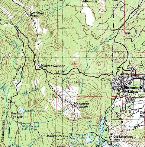
DevilsPostpile.jpg

Map courtesy of mytopo.com.


No TrackBacks

TrackBack URL: http://www.guidetohighway395.com/cgi-bin/mt/mt-t.cgi/37

Leave a comment

Categories

Pages

Powered by Movable Type 5.04

About this Entry

This page contains a single entry by David Archer published on January 20, 2008 8:48 PM.

Sotcher Lake / Mammoth Lakes Area was the previous entry in this blog.

Minaret Creek / Mammoth Area / Devils Postpile Area is the next entry in this blog.

Find recent content on the main index or look in the archives to find all content.