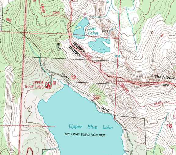
Upper Blue Lake / Highway 88

| No Comments | No TrackBacks

Upper Blue Lake  / Highway 88

Lost and Up Blue.jpg


Area: Blue Lakes Road, which lies a few miles east of Luther Pass off Highway 88

Elevation: 8200

Road condition: 

Day hikes to fishing:

Region: Highway 88 east of Carson Pass and Red Lake and than south on Blue Lakes Road         

Area/description:

Lake size:      Depth:      Species: Stocked rainbows and brook trout

Closest town or supplies: Markleeville

Contacts: PG&E Buildings and Land Services, (916) 386-5164, Carson Ranger District, (775) 882-2766.

Facilities: None

Nearest campground: Upper and Lower Blue Lakes

Boating: A boat launches are provided on both lakes.

Fishing season: General        Best times:

Tips:

Favorite lures or bait:

Favorite fly patterns:

Stocking information: 12,000 rainbows from 10-12-inches, along with 10,000 rainbow fingerlings for the upper lake and 15,000 brook trout fingerlings for the lower lake.

Additional information:

Nearby fishing:

Directions: From Highway 395, turn left on Highway 89 and drive _____miles to Markleeville.  Continue on Highway 89 to the junction with Highway 88 in Woodford, California.  Turn left (west) and drive __ miles to Blue Lakes Road, which is approximately two miles west of the Luther Pass Junction.  Turn left on Blue Lakes Road and drive …


From Highway 395 in Minden, Nevada, turn west on Highway 88 and drive 21 miles to Blue Lakes Road, which is approximately two miles west of the Luther Pass Junction.  Turn left on Blue Lakes Road and drive …


No TrackBacks

TrackBack URL: http://www.guidetohighway395.com/cgi-bin/mt/mt-t.cgi/223

Leave a comment

Categories

Pages

Powered by Movable Type 5.04

About this Entry

This page contains a single entry by David Archer published on March 30, 2008 1:45 PM.

Upper Blue Lake Campground / Highway 88 was the previous entry in this blog.

Lost Lakes / Highway 88 is the next entry in this blog.

Find recent content on the main index or look in the archives to find all content.