South Lake / Bishop Canyon

| No Comments | No TrackBacks

Lake Name: South Lake    Elevation: 9,755

Road condition:   Paved       Paved to gravel      Gravel/dirt  road         4x4 road

Day hike fishing: Two trails lead to separate high elevation lakes.  One trail leads to Treasury Lakes; the other trail leads to Bishop Pass and Bull Lake and Long Lake. Treasure Lakes is a 2.5 mile hike with a moderate grade.  Mostly Rainbows with a few hybrids and Golden trout, the fish are small but eager to take small flies. (Best source: Eastern Sierra Fishing Guide for Day Hikers by John Barbier.

Region: White Mountain Ranger District (760) 876-6200  Area/description: Bishop Creek drainage

Lake size: 166     Species: Rainbows, brookies and Browns

Closest town or supplies: Parcher’s Resort and South Lake Landing (760) 872-0334

Contacts: Parcher’s Resort (760) 872-0334; South Lake Landing; : Bishop Chamber of Commerce and Visitor Center (760) 873-8405; Barret’s Outfitters (760) 872-3830; Brock’s Flyfishing Specialists (760) 872-3581; Culver’s Sporting Goods (760) 872-8361; Mac’s Sporting Goods (760) 872-9201

Facilities: Lodge, marina, grocery store, bait and tackle; boat launch

Nearest campground: Four Jeffrey

Fishing season: General        Best times: Spring and fall

Tips: Because the banks are steep and access to the shoreline is limited, South Lake is best fished from a boat.  The best spots are the numerous inlets at the back of the lake. Bait fishermen, using Power Bait and night crawlers, do well at the dam.  Typically the lake is frozen over on opening day and ice fishermen enjoy good catches.  Mid-summer trolling with lures is popular as well. (See Category: Fishing Tips – Best Lures and Bait)

Stocking information: 24,000 Rainbows

Additional information: South Lake is heavily stocked and heavily fished.

Nearby fishing: Fish the outlet, which is Bishop Creek

Directions: Turn left on Highway 168 from Highway 395 in Bishop.  Follow Highway 168 for fifteen miles.  Turn left on South Lake Road and proceed seven miles to the lake.
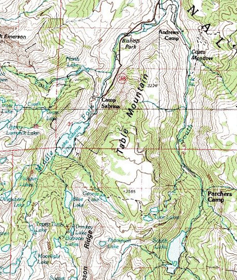
LakeSabrina.jpg

Map courtesy of mytopo.com.

No TrackBacks

TrackBack URL: http://www.guidetohighway395.com/cgi-bin/mt/mt-t.cgi/121

Leave a comment

Categories

Pages

OpenID accepted here Learn more about OpenID
Powered by Movable Type 5.04

About this Entry

This page contains a single entry by David Archer published on January 26, 2008 4:39 PM.

Oh! Ridge Campground (near June Lake) was the previous entry in this blog.

Lone Pine, California is the next entry in this blog.

Find recent content on the main index or look in the archives to find all content.