Leavitt Lake / Highway 108 / Bridgeport Area

| No Comments | No TrackBacks
Leavitt Lake.jpg
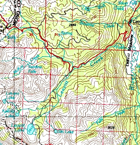
Map courtesy of mytopo.com.

Leavitt
Lake


Elevation: 9,556

Road condition:   4x4 road

Region: Highway 108     Area/description: The Forest Service keeps a lock on the gate until they decide that the road is passable.  The road is rough, and it crosses a couple of small stream crossings, which can be much higher in the early summer.  The lake is basically a barren looking landscape with few trees, but the fishing is generally good.  Koenig Lake and Latopie Lake are reached from Leavitt Lake in a day hike.

Lake size: 58 acres   Species: Rainbows and Brookies in the 7 to 10-range

Closest town or supplies: Bridgeport

Nearest campground: Leavitt Meadow Campground, Deadman Campground

Fishing season: The general fishing season opens the last Saturday in April and closes November 15.

Fishing Tips:

Favorite lures or bait:

Favorite fly patterns:

Stocking information:

Additional information:

Nearby fishing: West Fork of Walker River

Directions: From Bridgeport drive north seventeen miles to the junction of Highway 108.  Turn west on Highway 108 and drive 11 miles.  Look for a small sign on the left to Leavitt Lake.  Follow the rough road approximately three miles to the lake.


No TrackBacks

TrackBack URL: http://www.guidetohighway395.com/cgi-bin/mt/mt-t.cgi/172

Leave a comment

Categories

Pages

OpenID accepted here Learn more about OpenID
Powered by Movable Type 5.04

About this Entry

This page contains a single entry by David Archer published on February 12, 2008 2:33 PM.

Roosevelt Lake and Lane Lake / Bridgeport Area was the previous entry in this blog.

East Fork of the Walker River / Bridgeport Area is the next entry in this blog.

Find recent content on the main index or look in the archives to find all content.